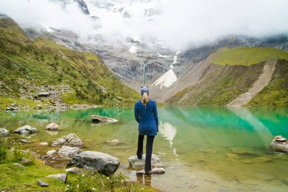
The cordillera blanca is Peru’s high-Andes range in the Áncash region east of Huaraz, much of it protected inside Huascarán National Park and known for turquoise glacial lakes and peaks like Huascarán and Alpamayo; base in Huaraz, go in the dry season (May to September), acclimatize 1–2 days, then pick day hikes such as Laguna 69 or Churup, the Santa Cruz trek, or guided climbs if you have mountaineering experience; typical costs: $20–35 for an overnight bus from Lima, $25–40 for a guided day tour, and $200–400 for a 3–4 day trek, plus about $10–15 per day in park fees.
That’s the short version: fly to Lima, bus to Huaraz, sleep high but easy the first nights, and build up from gentle acclimatization walks to iconic lakes or a short trek; strong climbers can hire certified guides in Huaraz for alpine objectives, while most visitors will be happiest with day hikes and the classic Santa Cruz route.
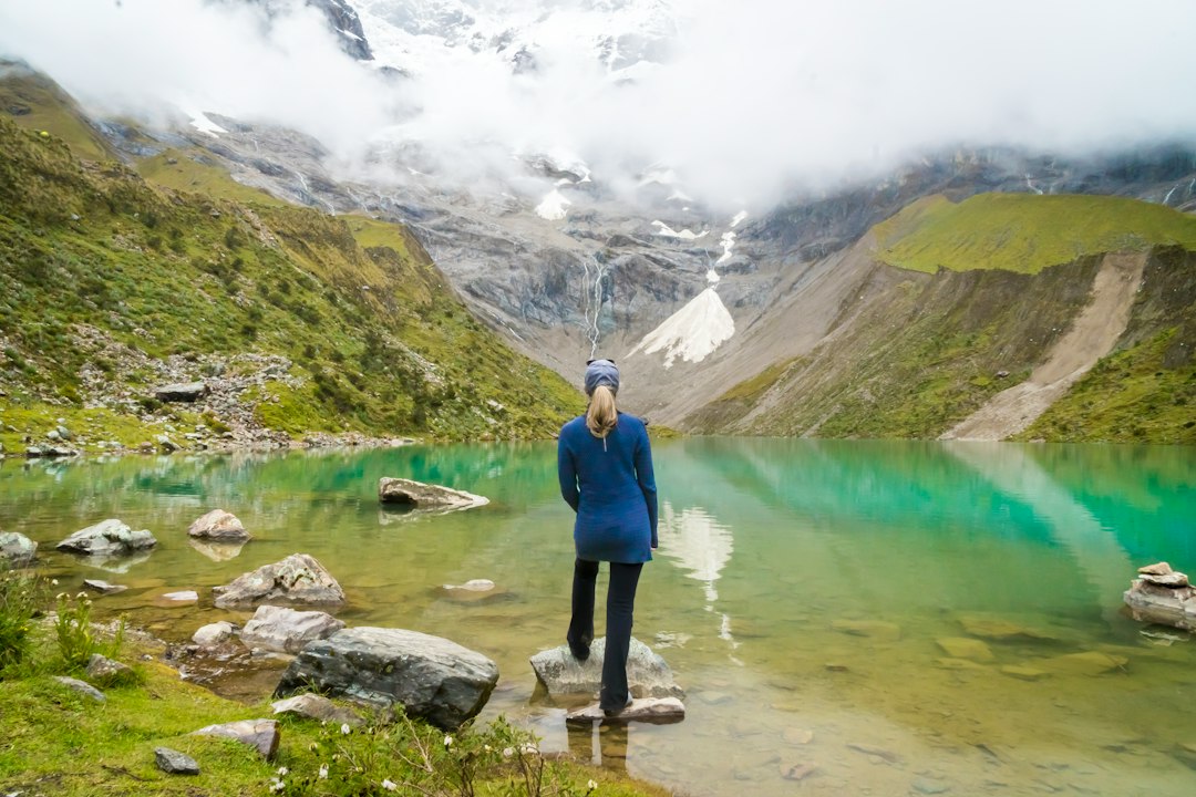
cordillera blanca at a glance: where, why, best months, costs
This range stretches for roughly 120 miles within the north-central Peruvian Andes. On the west side sits Huaraz (10,140 feet/3,090 meters), the service hub for guides, rentals and transport. The east-facing slopes feed sapphire lagoons such as Parón and the twin Llanganuco lakes. Huascarán National Park, a UNESCO World Heritage Site and Biosphere Reserve, protects most of the high terrain.
Why go? The contrast is sharp: clean granite, sweeping glaciers, and valleys carpeted with grasses and queñual forest. For day hikers the appeal is the density of lake basins reachable in one day. For trekkers, classic circuits like Santa Cruz thread two or three valleys over graceful passes. For alpinists, forgiving snow domes like Pisco share valleys with technical lines like Tocllaraju and the country’s highest point, Huascarán.
Best months are May through September when mornings are typically clear and afternoons breezy; October and April can deliver vivid green hillsides and fewer crowds but more unsettled weather; November to March is the rainy season with frequent clouds, slick trails and occasional road washouts.
Budget snapshot per person: $20–35 for the Lima–Huaraz overnight bus (8–9 hours), $25–40 for a shared day tour to a lake, $200–400 for a 3–4 day trek depending on group size and inclusions, about $10–15 per day in Huascarán NP fees (payable in soles), and modest extra costs for rentals (boots, crampons, tents) if you arrive without gear.
Common pitfalls to avoid: rushing acclimatization, underestimating driving times to trailheads, visiting deep in the wet season expecting Laguna 69 to look like brochure photos, and assuming technical peaks are just hikes—many climbs require glacier travel skills, current conditions knowledge and a licensed guide by local expectation or regulation.
Getting there and where to base
Most travelers ride an overnight coach from Lima to Huaraz. The journey takes roughly 8–9 hours on paved roads, with multiple companies offering reclining seats and departures each evening. Flights to the small Anta airport near Huaraz have been sporadic over the years and are often suspended; bus remains the reliable option.
Base in Huaraz for lodging, food, pharmacies, guide services and gear rental. It’s where day-tour vans and colectivos depart and where you can pick up last-minute items like fuel or extra layers. If you prefer quieter nights closer to trailheads, Yungay and Caraz are smaller base towns with easy access to Parón and the Llanganuco valley, though services thin out compared to Huaraz.
Local transport options include colectivos (shared minivans), tour vans that bundle transport and a guide for day hikes, and private taxis for exact start times. Typical road times from Huaraz, assuming current conditions: Parón trailhead via Caraz 2.5–3 hours; the Llanganuco valley and Cebolla Pampa (Laguna 69 start) 2.5–3 hours; Pitec (Laguna Churup) around 45–60 minutes; the Ishinca or Llanganuco/Pisco valleys 1.5–3 hours depending on road works and checkpoints. Dirt segments can be bumpy; plan a cushion.
For arrivals: spend your first day strolling Huaraz or heading to a low acclimatization walk like Mirador de Wilcacocha. Sleep, hydrate, and avoid sprinting into steep trails within 24 hours of arrival.
Best things to do in the Cordillera Blanca
Start with day hikes. They let you see the range’s color and scale without committing to multi-day logistics. Three reliable options:
- Wilcacocha (approx. 3,700 m/12,140 ft): a half-day acclimatization walk with valley views; simple trails, moderate hills, and flexible start times.
- Laguna Churup (approx. 4,450 m/14,600 ft): 3–5 hours round trip from Pitec including a short, fixed-cable scramble beside a waterfall; a great test of how your body feels above 14,000 ft.
- Laguna 69 (approx. 4,600 m/15,090 ft): a classic full-day hike from Cebolla Pampa with roughly 800–900 m/2,600–3,000 ft of elevation gain; long but spectacular.
Easy scenic days include a van ride to Laguna Parón (4,200 m/13,780 ft) for a short lakeside hike to the overlook and views of Artesonraju’s pyramid, Llanganuco’s twin lakes for photography and gentle strolls, and the road-based Pastoruri snowfield area, which offers a short walk to high terrain when open. Pair nature with culture by booking a day trip to Chavín de Huántar, a pre-Inca ceremonial center reachable from Huaraz, to add context to the region’s long human story.
Difficulty cues at a glance: Wilcacocha is easy; Churup is moderate with a short cable-protected rock step; Laguna 69 is strenuous for a day but on a good path; Parón and Llanganuco are mostly transport days with optional light walks.
When you’re ready to step up, the Santa Cruz trek (3–4 days) threads valleys below peaks like Artesonraju and Alpamayo, often crossing Punta Unión pass near 4,750 m/15,580 ft. Longer circuits like the Alpamayo Circuit connect valleys into 7–10 day journeys for experienced backpackers with a solid acclimatization base and logistics.
Experienced alpinists can add entry-level glacier objectives such as Nevado Pisco or the Ishinca Valley combo (Urus and Ishinca) and, with more skill and support, technical summits like Tocllaraju or the high, serious Huascarán. Hire UIAGM-certified guides through Huaraz agencies and build in extra days for weather or conditions.
Cordillera Blanca treks and climbs compared
Use the table below to compare popular routes by duration, distance, altitude and suitability. Costs are broad estimates for shared services in Huaraz and can change; check with local operators for current inclusions and group sizes.
| Route | Type | Duration | Distance | Max elevation | Elev. gain | Difficulty | Typical cost (USD) | Guide? | Start/End | Highlights |
|---|---|---|---|---|---|---|---|---|---|---|
| Wilcacocha | Day hike | 3–4 hrs | 6–8 km / 4–5 mi | 3,700 m / 12,140 ft | 300–400 m / 1,000–1,300 ft | Easy | $10–20 (DIY), $25–30 (tour) | No | Huaraz–Wilcacocha | Low-stress views, acclimatization |
| Laguna Churup | Day hike | 3–5 hrs | 6–8 km / 4–5 mi | 4,450 m / 14,600 ft | 600–700 m / 2,000–2,300 ft | Moderate | $10–20 (DIY), $25–35 (tour) | Recommended group | Pitec trailhead loop | Turquoise lake, short scramble |
| Laguna 69 | Day hike | 6–8 hrs | 13–16 km / 8–10 mi | 4,600 m / 15,090 ft | 800–900 m / 2,600–3,000 ft | Hard (day) | $25–40 (tour incl. transport) | No | Cebolla Pampa out/back | Iconic blue lake, big peaks |
| Laguna Parón | Day hike | 2–4 hrs (optional) | 2–6 km / 1–4 mi | 4,200 m / 13,780 ft | 200–300 m / 650–1,000 ft | Easy | $25–35 (tour) | No | Caraz–Parón | Lakeside overlook, Artesonraju |
| Llanganuco lakes | Scenic stop | Flexible | Short walks | 3,850 m / 12,630 ft | Minimal | Easy | $25–35 (tour) | No | Yungay–Llanganuco | Mirror lakes, Huandoy views |
| Santa Cruz trek | Trek | 3–4 days | 45–50 km / 28–31 mi | 4,750 m / 15,580 ft | ~1,800 m / 5,900 ft total | Moderate | $200–400 (group) | Recommended | Cashapampa–Vaquería (or reverse) | Valley-to-valley, Punta Unión |
| Alpamayo Circuit | Trek | 7–10 days | 90–120 km / 56–75 mi | 5,000 m+ passes | Significant | Hard | $500–900 (group) | Recommended | Varies around Alpamayo massif | Remote passes, peak cirques |
| Ishinca Valley (Urus/Ishinca) | Climb | 2–4 days | Approach + summit | 5,530 m / 18,143 ft | Glacier gain | Technical (basic) | $400–700+ | Yes (recommended/expected) | Pashpa/Collón–Ishinca | Intro glacier peaks |
| Nevado Pisco | Climb | 2–3 days | Approach + summit | 5,752 m / 18,871 ft | Glacier gain | Technical (basic) | $400–700+ | Yes (recommended/expected) | Yungay–Pisco BC | Wide summit views |
| Tocllaraju | Climb | 3–4 days | Approach + summit | 6,032 m / 19,790 ft | Steeper snow/ice | Technical | $600–1,000+ | Yes | Ishinca Valley | Classic ridge and headwall |
| Huascarán (Sur/Norte) | Climb | 5–7+ days | Approach + summit | 6,768 m / 22,205 ft | Big glacier gain | Technical, serious | $1,000–2,000+ (varies) | Yes | Musho–High Camps | Highest in Peru, objective hazards |
Is Huaraz worth visiting? If you like mountains, yes. Even two days will fill up with lake color, bakeries and market fruit, and a sense of scale you rarely get so close to a city. How hard is Huascarán? It’s reserved for experienced alpinists with glacier, crevasse rescue and high-altitude experience; conditions change year to year, and reputable agencies can brief you on recent serac and bergschrund realities.
When to go: weather, seasons and crowds
The dry season from May to September brings the most stable weather: blue mornings, some afternoon wind and occasional high clouds. Nights get cold at altitude; frosts are common above 4,000 m even when days feel warm in the sun. Snowstorms can still occur any time in shoulder months, especially on high passes and glaciers.
October and April are shoulder months. Landscapes look greener, waterfalls run strong and crowds thin, but thunderstorms and cloud cover become more likely. November to March is wet: mud on valley paths, slick slabs near lakes, reduced mountain views and higher odds of road issues. If this is your only window, favor lower, shorter objectives and build buffer days.
Month-by-month quick notes:
- May: Early dry; cool nights; some trails still recovering from wet-season ruts.
- June–July: Prime hiking; cold nights; busiest weeks around local holidays.
- August: Peak crowds on Laguna 69 and Santa Cruz; book transport early.
- September: Still stable; slightly quieter; good for treks and Pisco.
- October: More clouds, but vivid meadows; watch forecasts closely.
Itineraries and acclimatization you can actually follow
Altitude humility pays off. Give yourself 1–2 gentle days before big effort, drink water, and keep your sleeping elevation reasonable. These sample sequences assume arrival in Huaraz on Day 0.
Two-day plan (taster): Day 1 walk Wilcacocha or an easy city viewpoint and visit the Andean market. Day 2 hire a day tour to Parón or Llanganuco for views with modest exertion; if you feel strong, attempt Laguna Churup instead.
Four-day plan (hike-forward): Day 1 Wilcacocha or Churup (depending on how you feel). Day 2 Laguna 69 with a tour van to avoid parking headaches. Day 3 rest morning in Huaraz, then hot springs or short walk; Day 4 pick another lake (e.g., Parón) or start Santa Cruz if you have a fifth day.
Seven-day plan (trek or climb): Day 1 easy strolls in town. Day 2 Churup. Day 3 Laguna 69 to test higher effort. Day 4 rest and gear check; pay park fees and confirm transport. Day 5–8 Santa Cruz trek (3–4 days) or Ishinca Valley overnights for Urus/Ishinca or Pisco with a guide. Keep Day 9 flexible for weather or recovery.
Common mistakes and fixes:
- Stacking two hard days first—swap the order to build gradually.
- Dehydration—carry at least 2 liters and refill from boiled or treated sources at camp.
- Underestimating cold—pack a warm layer for wind-exposed passes even in sun.
- Relying on card payments—bring soles cash for park checkpoints and trailhead breakfasts.
- Skipping rest—sleep low when possible between pushes; take a half-day in town after a big hike.
Practicalities: permits, guides, rentals and on-the-ground costs
Fees and permits: Huascarán National Park collects entry fees at gates or ranger posts; bring cash in soles and photo ID. Multi-day tickets are sometimes offered; ask at the park office in Huaraz. Overnight treks and technical climbs may require registration, and for certain glacier routes local regulations and checkpoints expect a certified UIAGM guide. Confirm the latest rules at the park office before you commit to an itinerary.
Guided vs independent: Day hikes are commonly done independently or on inexpensive shared tours, which simplify transport and timelines. Treks can be self-supported if you are experienced with high camps and weather, but many visitors choose arrieros (donkey drivers) and cooks through agencies for comfort and logistics. For glacier climbs, a guide is strongly recommended and may be required; ask agencies for ratios, equipment lists, and recent route conditions.
Gear rentals: Huaraz has multiple rental shops for boots, trekking poles, tents, sleeping bags, stoves and alpine gear (crampons, axes, helmets). Typical day rates: $3–5 for poles, $8–12 for tents, $8–15 for sleeping bags, and $10–20 for crampons or helmets. Inspect zippers, liners and crampon bails before committing. For a complete packing reference, see our Alpine Climbing Gear Checklist and our broader Mountaineering Gear Checklist.
Packing essentials (beyond the usual): sun hat and high-SPF sunscreen, lip balm, light gloves, warm hat, windproof jacket, one insulating midlayer, quick-dry base layers, water purification method, headlamp, paper map or offline maps, power bank, and cash for gates and snacks. For safety habits and objective planning, read our Mountaineering Safety Checklist.
Typical on-the-ground expenses: Shared taxi or colectivo within the valley $2–5 per leg; day-tour van to Parón or Laguna 69 $25–40; agency-organized Santa Cruz trek $200–400 depending on services; guided entry-level climbs (group) often start in the mid-hundreds with equipment and porterage extra. Tips for cooks and arrieros are customary.
Travel responsibly: glaciers, culture and Leave No Trace
Glaciers in the Cordillera Blanca have been retreating for decades. Trails and moraine ridges can shift year to year as ice thins and meltwater reroutes. Stick to established paths and signed camp spots to reduce erosion and to avoid trampling delicate high-altitude vegetation. Human waste should be handled with catholes at least 70 meters from streams or carried out where regulations specify; pack out all trash including tissue and food scraps.
Respect communities along access roads. Hire local drivers, arrieros and cooks when you can; greet people you meet and avoid photographing without permission. Many valleys have small tolls or community gate collections that maintain rough roads—carry small bills in soles.
Finally, learn and practice the core principles of responsible mountain travel. Our primer on Leave No Trace for mountaineers covers campsite selection, waste, stove use and how to reduce wildlife impacts. The Cordillera Blanca is as fragile as it is beautiful; good habits help keep it that way.