Introduction to Mountaineering Navigation
Mountaineering navigation is a crucial skill to have when exploring the great outdoors. It involves using various tools like maps, compasses, and GPS devices to help chart routes, plan journeys, and ultimately find your way around. The purpose of this guide is to provide an overview of the basics of mountaineering navigation, and how to get started using the various tools available.
It is important to understand the fundamentals of mountaineering navigation before venturing out on the trail. This guide will provide an overview of the tools needed, general usage of each, and how to navigate with them, as well as providing resources for further reading. Whether you plan to go out for a day hike or a multi-day trek, this guide will provide you with the basic knowledge needed for successful and safe mountaineering navigation.
History of Mountaineering Navigation
Mountaineering navigation has come a long way since the days of explorers, like Lewis and Clark. Back then, navigation was done using stars, primitive maps, or guesswork. As technology improved, navigational tools for mountaineers became more advanced.
The invention of the compass in the 18th century was a major step forward for mountaineers, allowing them to have an accurate reference point for directions. The development of GPS technology in the late 20th century made finding exact locations much easier.
The importance of developing effective navigation tools cannot be understated when it comes to mountaineering. To successfully navigate a route, it is necessary to know the terrain, avoid dangerous conditions, and plan for potential risks.
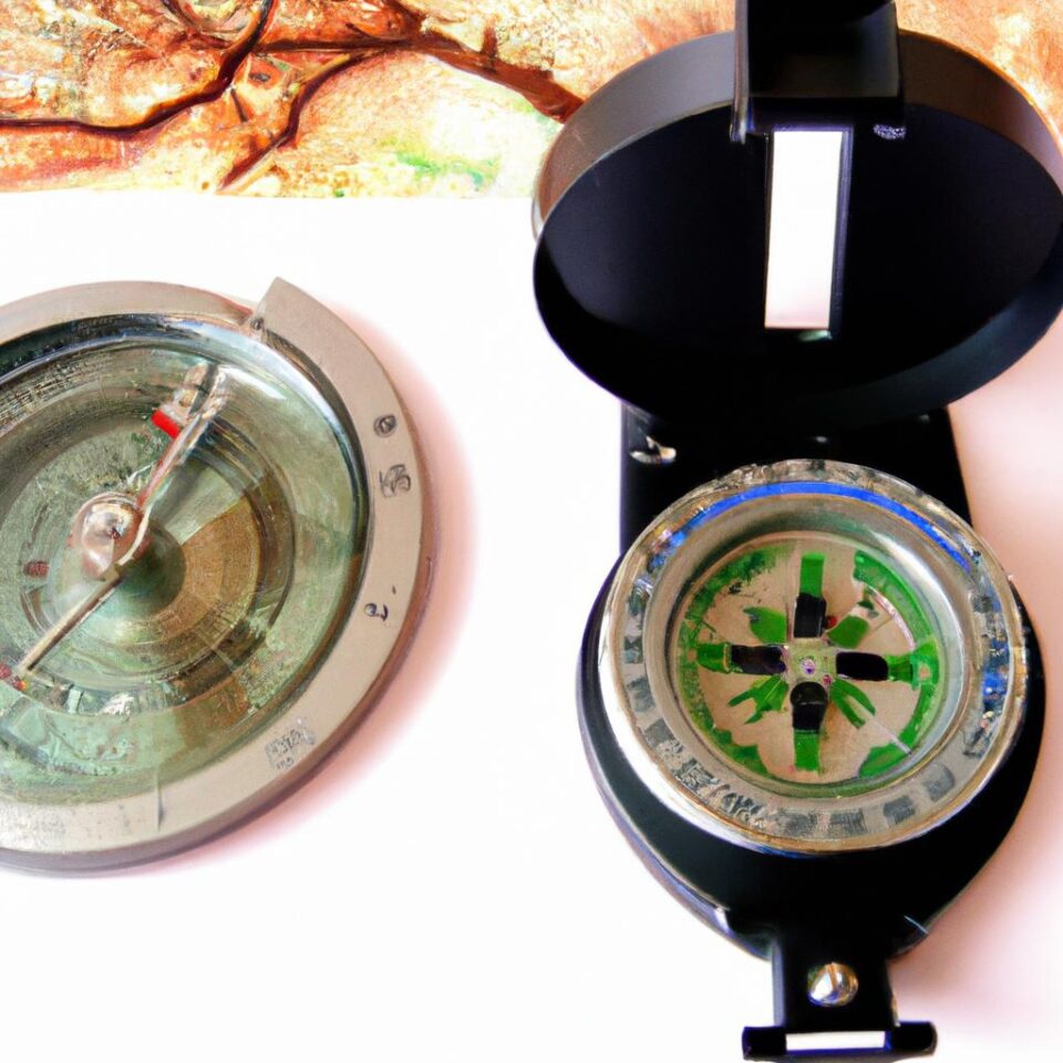
Overview of Common Mountaineering Navigation Tools
Navigation when mountaineering can be a tricky task and can be the difference between life and death. Fortunately, there are a variety of tools at your disposal that can help you stay on track. Maps, compasses, and Global Positioning Systems (GPS) devices are the three primary tools used in mountaineering navigation.
Maps are a great aid when it comes to tracking your journey. While a topographical map displays terrain and elevation, a navigational map shows trails and parks, roads and other geographic features, and landmarks like buildings and rivers. With a little practice, you can use maps to navigate from one point to another in mountainous terrain. Maps also give you an idea of the distance between two points and knowledge of the terrain before you set out.
Compasses are also an invaluable tool when it comes to mountaineering navigation. A directional compass is a pocket-sized device that tells you the direction you are heading in and how far you are away from your destination. By taking bearings from objects such as trees and rocks, you can use a compass to figure out your position relative to where you want to go and adjust your course. Compasses are especially useful in low visibility or poor weather conditions.
Finally, GPS devices are essential for any mountaineer. Both handheld and smartphone GPS units can provide accurate coordinates of your exact location which can be used for navigating and tracking your journey. They also help you estimate distance, calculate routes, keep track of elevation, and share your location with others conveniently.
Establishing Coordinates for Mountaineering Navigation using a GPS Device
When you’re navigating with a GPS device, you first need to be able to determine and set your coordinates. Coordinates are used to locate points in the environment accurately and precisely. When mountaineering, knowing your coordinates is essential for finding routes, estimating distances, navigating in poor weather or visibility, and using navigation tools like maps and compasses.
The location of a point is determined by two sets of numbers: latitude and longitude. GPS devices have a receiver that can pick up signals from satellites that orbit the Earth. Each satellite works like a clock, sending signals containing its exact position in space along with the time it was sent back to the GPS device on the ground. The GPS device then uses this information to calculate its own latitude and longitude coordinates.
Using a GPS device is an accurate way of establishing coordinates. You can also set coordinates manually by entering them into the device. Most GPS devices will allow you to enter coordinates in either degrees, minutes, and seconds (DMS) or Universal Transverse Mercator (UTM). Most maps also provide coordinates in DMS or UTM form.
Once you’ve established your coordinates, you’ll be able to use your GPS device to plot routes, find distances, and navigate even in poor weather or visibility. Knowing how to set and use coordinates will ensure accurate navigation and help keep you safe while mountaineering.
Navigating with a Map
When mountaineering, navigating with a map and compass is essential. The most reliable way to find your way in the outdoors is to use a combination of these two tools. Different types of maps can provide information about the terrain and features of the area. Knowing how to orient and read maps is fundamental knowledge for mountaineers.
Two of the most common systems used for map reading are the Universal Transverse Mercator (UTM) system and the International Union of Official Mapping (IUOM) system. The UTM system uses coordinates of latitude and longitude to identify points on the map. The IUOM system simply divides the map into numbered grids. Both systems have benefits, and should be used depending on the challenge at hand.
There are also several types of maps used for mountaineering navigation, including topographical maps, trail maps, and street maps. Topographical maps show natural terrain features such as mountains, rivers, and valleys. Trail maps show specific trails and pathways, while street maps show roads and highways. All of these maps can be helpful to the mountaineer when navigating.
The features of a map can also provide helpful navigational information. Contour lines on a map indicate changes in elevation, while landmasses are typically shown in green. By understanding the different features of a map, a mountaineer will be better able to navigate the area.
Sunny Day Navigation with a Compass
Navigating with a compass is an essential skill for mountaineering adventures. There are several steps involved in correctly navigating with a compass, in clear weather conditions. The first step is understanding how to find direction. This can be done by orientating the compass with the terrain and assigning a direction to magnetic North.
The second step in using a compass for navigation is taking a bearing from an object. This involves aligning the compass with the object and then turning the dial until the direction of travel is aligned with the bearing number. This type of navigation can be used to form a route between two objects.
Finally, navigating with a compass involves orientating a topographical map with the terrain. This requires understanding the symbols used on the map, and then rotating it until the symbols on the map match the terrain. This will allow a person to use the map to form their navigational route.
Being able to efficiently and accurately navigate with a compass is a critical part of mountaineering. By following these steps, it is possible to successfully navigate with a compass, in clear weather conditions.
Navigation in Poor Weather Conditions or Visibility
Navigating in poor weather conditions or visibility can be a challenge, especially when using standard navigation tools such as maps and compasses. Luckily, there are technologies available on the market to help make that challenge a little bit easier. In this section of the guide, we’ll look at landmarks, technologies, and the advantages and disadvantages of each.
Establishing landmarks is one of the most reliable methods of navigation in poor weather. When navigating with landmarks, it is important to identify the general direction to a landmark first, then use that as a reference point for travel. The advantage of this navigation method is it does not require any specialized equipment; just a clear view of the terrain. The disadvantage is that landmarks may not always be present or clearly visible in certain weather.
The second method we will look at is technologies. This includes GPS (Global Positioning System), smartphones, and other navigation-oriented technology. Each technology has its own advantages and disadvantages. GPS devices are generally the most accurate and effective when it comes to navigation in poor weather, but they do require batteries and other power sources. Smartphones are also capable of some navigation tasks, but require a good signal to be effective.
Finally, there are some other, less common technologies available for navigation in poor weather or visibility. Radar and LIDAR (Light Detection and Ranging) machines emit laser beams that travel through fog and darkness, providing navigation information. Unfortunately, these technologies are expensive and can be difficult to use.
In summary, navigating in poor weather or visibility can be a difficult task. Fortunately, there are a number of methods and technologies available to assist mountaineers in reaching their destination. Landmarks and technologies such as GPS, smartphones, and radar/LIDAR are all options worth considering.
Conclusion
Mountaineering navigation can be a complex process, depending on the navigational tools used. It is important for hikers and mountaineers to become familiar with the different types of maps, compasses, and other navigational tools available to them. Understanding the basics of each of these tools and how to use them effectively will help them have better experiences while out in the wilderness.
When it comes to navigating with a map, an important system to know is the IUOM system. It is important to also be familiar with UTM systems, and what features and types of maps are best for mountaineering navigation. For navigation in sunny conditions, hikers should be comfortable taking bearings from objects and orienting topographical maps. Finally, if visibility is poor, hikers should rely on other technologies or landmarks when they feel navigation assistance is necessary.
We hope that this guide has provided a comprehensive overview of mountaineering navigation using maps, compasses, and GPS devices. With the information provided, we trust that you can more confidently navigate your next mountaineering excursion.
Resources for Further Reading
If you would like to continue your exploration of mountaineering navigation, there are plenty of resources available on the web. Here are a few useful links that can help you get started:
- Outdoor Action Guide to Navigation
- Dummies Guide to Map and Compass Navigation
- GPS Information Guide to Using GPS
These links provide a wealth of information on different mountaineering navigation techniques and tools, from basic principles to more advanced concepts. The resources contained within them can be invaluable in helping to safely and effectively navigate in the outdoors.
comments: 0
